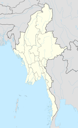
02.06.2561 Hpapun District or Mutraw District is a district of the Karen State in Myanmar.
01. Hpapun District or Mutraw District is a district of the Karen State in Myanmar.
************************************************
02.1 Hpapun Township ( also known by the Karen people as Mutraw or Bu Tho Township) is a township of Hpapun District in the Karen State of Myanmar.
***************************************************
03.1 Papun is a town in the Karen State of southern Burma.
*************************************************
03.2 Kamamaung is a town in Hpapun District, Kayin State of Myanmar (Burma).
Hpapun District
Hpapun District (Burmese: ဖာပွန်ခရိုင်); or Mutraw District (S'gaw Karen: မူထြီကီၢ်ရ့ၣ်) is a district of the Karen State in Myanmar. The principal town is Hpapun. According to 2014 Myanmar Census, the total population in Hpapun District is 35,085.[1]
Townships and towns[edit]
The district contains the following townships and towns:
References[edit]
- ^ Census Report. The 2014 Myanmar Population and Housing Census. 2. Naypyidaw: Ministry of Immigration and Population. May 2015. p. 51.
External links[edit]
- Kayin State - District Map Myanmar Information Management Unit (MIMU)
| This Kayin State location article is a stub. You can help Wikipedia by expanding it. |
************************************************
02.1 Hpapun Township ( also known by the Karen people as Mutraw or Bu Tho Township) is a township of Hpapun District in the Karen State of Myanmar.
Hpapun Township
| Hpapun Township ဖာပွန်မြို့နယ် ဖးဖူကီၢ်ဆၣ် | |
|---|---|
| Township | |
| Country | |
| State | Karen State |
| District | Hpapun District |
| Capital | Hpapun |
| Population (2014) | 35,085 |
| Time zone | MST (UTC+6:30) |
Hpapun Township (Burmese: ဖာပွန်မြို့နယ်; S'gaw Karen: ဖးဖူကီၢ်ဆၣ်; also known by the Karen people as Mutraw or Bu Tho Township) is a township of Hpapun District in the Karen State of Myanmar. It lies on the border of Thailand across the Salween River. The central part of the township is bounded on the west by the Yunzalin River. Hpapun Township's administrative center is Papun.
References[edit]
- "Forced Relocation Sites in Papun (Mu Traw) District, Karen State, Map by CIDKP Dec. 2000" in "13. Internally Displaced People and Forced Relocation" Facts on Human Rights Violation in Burma: 2002-2003, Online Burma/Myanmar Library
| This Kayin State location article is a stub. You can help Wikipedia by expanding it. |
***************************************************
03.1 Papun is a town in the Karen State of southern Burma.
Papun
(Redirected from Hpapun)
| Papun ဖးဖူဝ့ၢ်ဖိ Bu Tho/ဘုသိ | |
|---|---|
| town | |
| Coordinates: 18°03′53″N 97°26′42″ECoordinates: 18°03′53″N 97°26′42″E | |
| Country | |
| Division | |
| District | Hpa-an District |
| Township | Hpapun (Bu Tho) Township |
| Elevation | 56 ft (17 m) |
| Population (2014) | 2,000 |
| Time zone | MST (UTC+6.30) |
| Area code(s) | 58[1] |
Papun (S'gaw Karen: ဖးဖူဝ့ၢ်ဖိ) is a town in the Karen State of southern Burma. It is on the east side of the Yunzalin River. It is a former headquarters of Karen National Union and the Karen National Liberation Army.
It is the home of Papun Airport.
*************************************************
03.2 Kamamaung is a town in Hpapun District, Kayin State of Myanmar (Burma).
Kamamaung
| Kamamaung ကမမောင်း | |
|---|---|
| Town | |
| Coordinates: 17°20′49″N 97°39′10″ECoordinates: 17°20′49″N 97°39′10″E | |
| Country | |
| State | Kayin State |
| District | Hpapun District |
| Township | Hpapun Township |
| Population (2014) | 20,895[1] |
| Time zone | MST (UTC+6:30) |
Kamamaung (Burmese: ကမမောင်းမြို့) is a town in Hpapun District, Kayin State of Myanmar (Burma).[2]According to 2014 Myanmar Census, the total population in Kamamaung is 20,895.[1]
References[edit]
- ^ a b Census Report. The 2014 Myanmar Population and Housing Census. 2. Naypyidaw: Ministry of Immigration and Population. May 2015. p. 51.
- ^ "Township Map of Thandaunggyi" (PDF). Myanmar Information Management Unit. 3 May 2016. Retrieved 10 March 2018.
| This Kayin State location article is a stub. You can help Wikipedia by expanding it. |


ความคิดเห็น
แสดงความคิดเห็น